
Introduction
Methane presents upstream oil and gas operators with a two-sided problem. On the commercial side, an uncontrolled methane release can represent salable product leaving the location — gas that was produced, paid for, and never sold, with the loss compounding for as long as the event runs undetected. On the safety side, it's colorless, odorless, and highly flammable — a hazard that goes completely unnoticed without purpose-built detection.
Both problems share a common solution: monitoring. That monitoring spans handheld sensors carried by field personnel, infrared cameras mounted at the wellsite, drones sweeping pipeline corridors, and satellites mapping entire basins from orbit.
Each layer operates differently, detects differently, and covers different gaps. This guide maps the full landscape — ground-based sensors, aerial surveys, and satellites — explaining how each works, where it fits, and where it falls short. The goal is to give operators a clear framework for building the right combination before a missed detection or a regulatory inspection forces the issue.
Key Takeaways
- Unrecovered methane is lost salable product — rapid detection is an operational, commercial, and regulatory necessity
- A small fraction of sites drives the majority of measured emissions, so blanket inspection schedules spend budget inefficiently
- No single monitoring layer covers the full detection-to-quantification requirement
- Continuous fixed monitoring can support EPA compliance workflows when an approved method and monitoring plan apply
- Most large operators will need a layered approach: site-level sensors + aerial surveys + satellite benchmarking
Why Methane Monitoring Matters: Product Recovery, Safety, and Regulatory Compliance
The Product-Recovery Case
Methane that escapes is methane that never reaches a sales meter. For upstream operators, the commercial challenge isn't average emissions across a portfolio — it's that losses are highly concentrated. Field measurement campaigns consistently find that a small percentage of facilities account for roughly half of measured emissions at any given time, and that the population of high-emitting sites shifts over time rather than staying fixed.
That concentration has a direct budget implication. Detection programs have to be designed to find a small, moving population of large emitters, because that is where both the recoverable product and the regulatory exposure actually sit.
Operator-led measurement programs are now producing exactly this kind of basin-scale picture. The Appalachian Methane Initiative (AMI), whose science is led by the Energy Emissions Modeling and Data Lab at The University of Texas at Austin, has surveyed roughly 17,000 site measurements across approximately 31,800 square miles of the Appalachian Basin. Its most recent campaign reported average methane emission intensity of 0.064% at production facilities and 0.099% at midstream facilities, confirming the basin for a second consecutive year as the lowest-intensity major producing basin in the United States.
That result matters commercially as much as technically. It demonstrates that measurement-based programs can document strong operational performance rather than only surfacing problems — and for an individual operator, the same continuous data that satisfies a regulator also evidences efficient product capture.
The Safety Case
Methane's flammable range in air is 5–15% by volume. Below that threshold it's an asphyxiant, displacing oxygen in confined or poorly ventilated spaces and creating risks ranging from dizziness to unconsciousness.
The problem compounds at remote wellsites: workers visit infrequently, no one is present to notice gradual accumulation, and by the time a leak is detectable without instruments, conditions may already be dangerous.
The Regulatory Case
US upstream operators face compliance obligations from multiple directions simultaneously:
- EPA 40 CFR Part 60 Subpart OOOOb — New Source Performance Standards for facilities whose construction, modification, or reconstruction began after December 6, 2022. Covered sources include well sites, compressor stations, storage vessels, and pneumatics.
- OGMP 2.0 Level 4/5 — The Oil & Gas Methane Partnership's measurement-based reporting tiers. Level 4 requires source-level measurement-informed quantification; Level 5 adds independent site-level measurements and reconciliation.
- SASB Oil & Gas E&P — An ESG disclosure framework now expected by investors and lenders, demanding quantified emissions data, not estimates.

What that means in practice: the monitoring method you choose determines the quality of the data you submit — and regulators and auditors are increasingly scrutinizing the methodology, not just the numbers.
Ground-Based Methane Monitoring Technologies
Ground-based methods form the most direct, granular layer of the monitoring stack. Three primary categories cover the range from handheld instruments to fixed continuous systems.
Handheld and Portable Gas Sensors
Catalytic bead, electrochemical, and photoionization detector (PID) sensors detect methane concentrations above a set threshold at a single physical point. Workers carry them during site inspections to check for leaks at valves, fittings, and equipment connections.
As a first-line safety tool, they serve a clear purpose. The limitations, though, are significant:
- Require a person to be physically present at the measurement point
- Miss diffuse or low-concentration emissions that spread across a site
- Cannot detect intermittent leaks occurring between inspection visits
- Provide no quantification of leak volume or duration
Optical Gas Imaging (OGI) with Infrared Cameras
OGI cameras — particularly Long-Wave Infrared (LWIR) and Mid-Wave Infrared (MWIR) types — make otherwise invisible methane visible. They work by detecting how methane absorbs specific infrared wavelengths, rendering the gas as a visible plume on screen. Cooled MWIR cameras offer higher sensitivity, while uncooled LWIR cameras operate at lower cost with day-and-night capability, making them increasingly preferred for continuous field deployment.
Traditional leak detection and repair (LDAR) programs deploy OGI cameras during quarterly or annual walkthroughs under EPA Appendix K requirements. This approach works for component-level localization but carries a fundamental blind spot:
EPA's advanced methane technology program recognizes periodic screening and continuous monitoring as distinct approaches. Continuous monitoring can add visibility between scheduled surveys when an approved method and monitoring plan apply.
For facilities where episodic emissions are common, periodic OGI alone leaves significant regulatory and environmental exposure on the table.
Fixed Continuous and Multi-Sensor Monitoring Systems
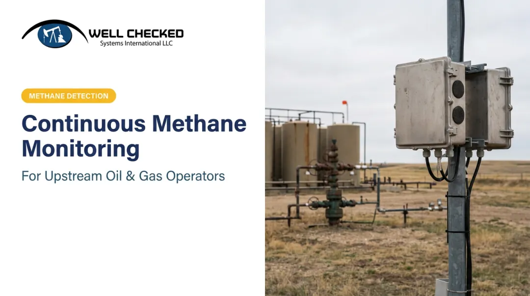
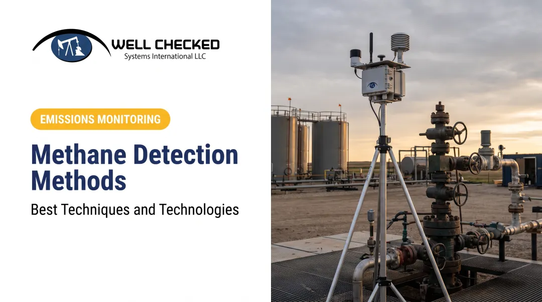
Fixed sensor arrays can reduce the gap left by periodic inspections by providing continuous coverage at instrumented or observable locations between visits.
The most capable platforms combine multiple sensing modalities in a single integrated system:
- High-resolution video with AI object detection — continuous visual surveillance of the full site
- LWIR optical gas imaging — day-and-night infrared monitoring for methane plumes
- Acoustic anomaly AI monitoring — detection of abnormal sounds from equipment malfunction or pressure anomalies
Cross-confirming signals across these modalities produces a materially different outcome than relying on any single sensor type. Well Checked's Zensory.ai™ platform runs an AI site-learning cycle of approximately two days per site to establish each wellsite's normal operational baseline.
After that calibration period, Zentinal Core™ focuses alerts on events that deviate from that baseline, helping separate routine process emissions and operational activity from system-validated leak anomalies. The system processes 1,500+ videos per site per day at production scale, enabling near-real-time anomaly detection without overwhelming operators with false positives.

Laser-based spectroscopy methods serve complementary roles in fixed perimeter configurations alongside multi-sensor platforms. These include Tunable Diode Laser Absorption Spectroscopy (TDLAS) and cavity ring-down spectrometry (CRDS). Open-path TDLAS beams a laser across a wellsite boundary, measuring path-integrated methane concentration. CRDS provides highly sensitive point concentration measurements, often used for quantification at specific locations. Both are recognized in EPA optical remote sensing guidance but require wind and dispersion modeling to infer source location and emission rate.
Aerial Methane Monitoring: Drones and Manned Aircraft
Aerial methods fill the mid-scale monitoring gap between individual wellsite sensors and regional satellite coverage. They don't replace either end of that stack, but they cover territory neither can handle well.
Drone-Based Detection
UAVs equipped with miniaturized infrared sensors or laser spectrometers can survey pipeline corridors, tank farms, and well pad clusters in a fraction of the time required by ground crews. An EPA-hosted 2023 study reported approximately 1–2 hours per production-site survey for drone-based methane detection.
Drones are best suited for:
- Targeted surveys of moderate-scale areas
- Rapid multi-site screening campaigns
- Prioritizing which sites warrant deeper ground-level investigation
Their limitations matter. Regulatory airspace constraints, battery and range limits, and weather sensitivity all constrain operational flexibility. Drone surveys produce periodic-snapshot data, not continuous coverage. A single flight captures one moment in time — not a reliable record of day-to-day emissions behavior.
Manned Aircraft Campaigns
Fixed-wing aircraft equipped with instruments such as AVIRIS-NG map methane enhancements across entire production regions by measuring concentrations upwind and downwind of source areas. NASA's AVIRIS-NG program uses integrated mass enhancement (IME) multiplied by modeled wind speed to estimate emission rates. The approach is technically rigorous, but requires substantial data processing and atmospheric modeling to produce reliable results.
These are high-cost, low-frequency tools — best suited for:
- Basin-scale research and regulatory verification campaigns
- Identifying high-emitting outliers across large production portfolios
- Supporting policy-level emissions inventory work
Published aerial survey campaigns using this approach have repeatedly found that a few hundred high-rate sources can account for roughly half of the emissions measured across a producing region — illustrating exactly the kind of portfolio-level triage manned aircraft campaigns do well.
Where aerial fits: Both drone and manned aircraft methods generate prioritization intelligence — they flag which sites or regions need ground-level follow-up, but neither provides the continuous, site-specific data that operational compliance and fugitive event response actually require.
Satellite-Based Methane Detection
How Methane Satellites Work
Satellites detect methane using imaging spectrometers that identify the gas's spectral fingerprint in reflected infrared sunlight, generating concentration maps across wide geographies. Two distinct architectures serve different purposes:
| Type | Resolution | Best Use |
|---|---|---|
| Point-source imagers | ~25–60 m pixels | Attribute emissions to specific facilities |
| Area-flux satellites | 3.5–10.5 km resolution | Measure regional average concentrations |

Point-source and area-flux satellites work in tandem: area mappers identify high-emission regions; point-source imagers then pinpoint specific facilities within those regions.
The Growing Constellation
Dozens of satellites now provide some level of methane monitoring capability across government, research, and commercial programs. Publicly funded instruments such as NASA's EMIT (60 m resolution) sit alongside a growing set of commercial point-source imagers in the ~25–30 m range. The constellation is expanding, broadening geographic coverage and improving revisit frequency for operators managing large site portfolios.
Satellite Limitations Operators Need to Understand
Satellites are a top-down verification layer, not a site-level monitoring substitute:
- Cloud cover and atmospheric interference can prevent detection entirely
- Minimum detection thresholds mean diffuse low-rate emissions go undetected
- Revisit frequency is improving but still produces periodic snapshots, not continuous records
- Attribution to specific equipment requires supplementary ground-level data
Satellite data is most valuable for portfolio triage: identifying which basins or facilities warrant deeper investigation and cross-checking operator-reported inventories against independent remote sensing. That triage function makes satellites a useful complement to the continuous ground-level monitoring methods covered in the sections that follow.
Continuous Monitoring vs. Periodic LDAR Inspections: What Operators Need to Know
The Core Distinction
Periodic LDAR inspections produce compliance snapshots. Continuous monitoring systems produce an unbroken data record. That difference has direct regulatory and financial consequences.
A leak that begins the day after a quarterly inspection can persist for up to 90 days before the next observation window. During that interval, operators have no data on whether an event occurred, how long it lasted, or how much methane was released. There is no ability to respond within any regulatory-relevant timeframe.
Continuous monitoring closes much of that gap. Well Checked's Zensory.ai™ platform enables operators to acknowledge, dispatch, and mitigate within 24 hours of a validated emission event — a response window that may help reduce potential compliance exposure, as reported by operators using the platform.
The Detect-and-Quantify Requirement
EPA OOOOb and OGMP 2.0 Level 4/5 don't just require detection — they require defensible quantification of emission volume and duration for certain compliance pathways. Detection without quantification leaves a documentation gap that regulators and ESG auditors are increasingly scrutinizing.
A tiered monitoring architecture addresses this directly:
- Detection layer — flags anomalies and identifies validated candidate fugitive events (Zentinal Core™)
- Quantification layer — generates documented emissions data designed to support regulatory workflows after the detection layer has validated an event (Zentinal IQ™)
This separation matters. Quantifying every raw sensor signal would contaminate compliance records with false-positive data. Zentinal IQ™ operates on Core-validated events, producing volume, duration, and rate data structured for EPA Subpart OOOOb submissions, OGMP 2.0 Level 4/5 reporting, and SASB ESG disclosures.

The Cost Reality
Route-based site-visit programs for mid-to-large operators run $1M–$5M+ annually, according to Well Checked's operational benchmarking. The figure reflects labor, vehicle miles, and the safety overhead of dispatching personnel regardless of whether site conditions warrant it.
Continuous monitoring shifts the model to operate-by-exception: dispatches happen only when a validated anomaly is confirmed, not on a fixed schedule. Unproductive travel drops sharply, and response speed improves in the same move.
The False-Alarm Problem
Continuous monitoring that can't distinguish normal operations from true leaks creates alert fatigue, a failure mode that undermines both operator confidence and compliance response. When every routine pressure event or controlled vent triggers an alert, operators stop responding.
AI-trained multi-sensor platforms solve this by learning what "normal" looks like at each specific site and focusing alerts on system-confirmed deviations. Key platform behaviors that prevent alert fatigue include:
- Site-specific baseline learning — the Zensory.ai™ platform's ~2-day AI site-learning cycle establishes what normal looks like before monitoring goes live
- Continuous refinement — ongoing alert-tuning services adjust the baseline as operations change
- Validated-event-only alerting — Zentinal Core™ filters routine process signals before any notification reaches an operator
Matching the Right Methane Monitoring Approach to Your Operation
No single technology covers the full range of scale, purpose, and frequency requirements that upstream operators face. Selecting an approach means being clear about three variables:
- Geographic scale — Individual wellsite vs. basin-level overview
- Purpose — Safety/operational, regulatory compliance, or ESG reporting
- Frequency requirement — Continuous real-time visibility vs. periodic compliance snapshot
Most large operators need all three layers working together.
The recommended monitoring stack for upstream O&G:
- Fixed continuous multi-sensor systems at individual wellsites — for operational awareness, regulatory compliance, and emissions quantification
- Aerial surveys — for periodic mid-scale verification and multi-site prioritization
- Satellite data — for basin-level benchmarking and super-emitter identification
Each layer informs the others. Satellite data identifies which basins show anomalous emission patterns. Aerial surveys then pinpoint specific source facilities within those basins. Site-level continuous monitoring does the heaviest regulatory lifting: confirming events, quantifying them, and generating the defensible data record that regulators and auditors require.

EPA OOOOb and OGMP 2.0 Level 4/5 now require measurement-based approaches over estimation for many operator categories. For those subject to these frameworks, continuous or high-frequency monitoring with documented detection and quantification methodology is the compliance standard — not a best practice upgrade.
Frequently Asked Questions
What is a methane monitor?
A methane monitor is any device or system designed to detect the presence or concentration of methane gas in the surrounding environment. These range from handheld single-point sensors used during safety inspections to fixed multi-sensor platforms — like Well Checked's Zensory.ai™ — that provide continuous, site-wide coverage for regulatory compliance.
How do you monitor methane emissions?
Methane emissions are monitored through a layered stack: ground-based OGI cameras and sensor arrays for site-level detection and quantification, drone and aircraft surveys for corridor or basin-scale screening, and satellites for regional coverage. Continuous fixed monitoring is increasingly the standard for upstream operators who need defensible compliance data rather than periodic snapshots.
How harmful is methane gas to humans?
Methane is non-toxic at low concentrations but acts as a simple asphyxiant at high levels, displacing oxygen in confined spaces and causing hypoxia. Its lower explosive limit in air is 5% by volume, making undetected accumulations in poorly ventilated wellsite structures a direct fire and explosion hazard for field workers.
What is the difference between methane detection and methane quantification?
Detection confirms that a methane emission event is occurring. Quantification measures how much gas was released, over what duration, and at what rate. EPA OOOOb and OGMP 2.0 Level 4/5 require defensible quantification data for certain compliance pathways — detection alone doesn't satisfy those reporting obligations.
What regulations require methane monitoring for oil and gas operators?
The primary US federal rule is EPA 40 CFR Part 60 Subpart OOOOb (new sources). Voluntary but increasingly expected frameworks — OGMP 2.0 Level 4/5 and SASB Oil & Gas E&P — both require quantified emissions data that periodic inspections cannot reliably produce.
What is optical gas imaging (OGI)?
OGI uses infrared cameras — typically LWIR or MWIR — to visualize methane and other hydrocarbon gases that are invisible to the naked eye. The cameras detect how those gases absorb specific infrared wavelengths and render the emission as a visible plume on screen, enabling inspectors or automated systems to pinpoint the source and scale of a leak.